
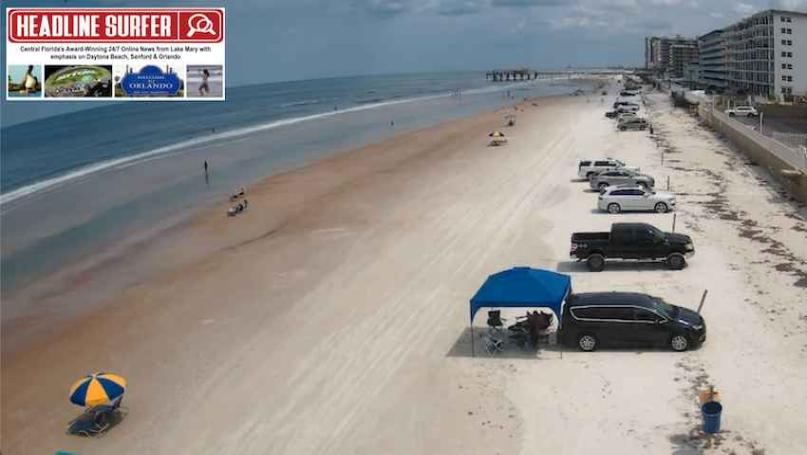
Photos for Headline Surfer / TOP: Due to the rainy weather, there is not much of a weekend crowd at the beach in Daytona Beach Shores, as shown in this beach cam screenshot from the Dunlawton Avenue ramp looking south.
By SERA KING / Headline Surfer
ORLANDO, Fla. -- Rain is in the forecast until at least Wednesday here in East Central Florida, from Orlando and the Attractions and along the Interstate 4 corridor to the World's Most Famous Beach in Daytona and other beaches along I-95.
Showers and thunderstorms are likely before 2 a.m., followed by a slight chance of showers.
Some of the overnight storms could produce heavy rainfall. It's mostly cloudy, with a low around 72. A south-southwest wind of 5 to 10 mph will become east in the evening. The chance of precipitation is 70%. New rainfall amounts between a quarter and half of an inch are possible.
Some of the overnight storms could produce heavy rainfall. It's mostly cloudy, with a low around 72. A south-southwest wind of 5 to 10 mph will become east in the evening. The chance of precipitation is 70%. New rainfall amounts between a quarter and half of an inch are possible.
Sunday: A chance of showers and thunderstorms, then showers likely and possibly a thunderstorm after 4 pm. Mostly cloudy, with a high near 86. South southeast wind around 10 mph, with gusts as high as 20 mph. The chance of precipitation is 60%. New rainfall amounts between a quarter and half of an inch are possible.
Sunday Night: Showers and possibly a thunderstorm. Low around 73. Southeast wind around 10 mph. The chance of precipitation is 80% -- new rainfall amounts between a quarter and half of an inch are possible.
Monday: Showers and thunderstorms are possible after 11 a.m., and some of the storms could produce heavy rainfall. The high will be near 80. The southeast wind will be around 10 mph. The chance of precipitation is 90%.
Monday Night: Showers and possibly a thunderstorm before 2 a.m., then a chance of showers between 2 a.m. and 5 a.m., and showers and thunderstorms after 5 a.m. Some of the storms could produce heavy rainfall. The low will be around 70. The southeast wind will be around 5 mph. The chance of precipitation is 80%.
Tuesday: A chance of showers and thunderstorms before 8 am, then showers between 8 am and 11 am, then showers and thunderstorms after 11 am. Mostly sunny, with a high near 84. West southwest wind 5 to 10 mph. The chance of precipitation is 40%.
Tuesday Night: Mostly clear, with a low around 68. West southwest wind around 5 mph.
Wednesday: Sunny, with a high near 87. West wind around 5 mph.
Wednesday Night: It will be mostly clear, with a low around 68. The west wind will be around 5 mph and calm in the evening.
Thursday: Sunny, with a high near 90. Calm wind becoming west southwest around 5 mph in the afternoon.
Thursday Night: Mostly clear, with a low around 71. West wind around 5 mph.
Friday: Sunny, with a high near 93. West-northwest wind around 5 mph.
Friday Night: It will be mostly clear, with a low around 73. The wind will be north at around 5 mph, becoming west southwest in the evening.
Saturday: Mostly sunny and hot, with a high near 95. West wind around 5 mph.
 About the Byline Writer: